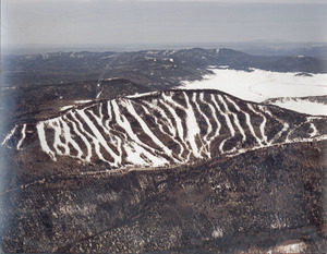
Pajarito Mountain in Los Alamos has some of the states best skiing ever. I would say the hill is second only to Taos as far as challenge and beauty. It’s where I learned to snow ski.
I never took lessons, my dad would tell us to ski behind an on-going lesson, eavesdrop on the instructor, then do what they said. More than anything, we just let loose and skied. Being young, what could happen? (Plenty did, but that’s another story.)
The way I remember a day of skiing, was to ride the T-bar to the top of the mountain, (we didn’t have chair lift in those days), then start on one side of the mountain, and ski down each and every slope. When you had hit them all, the day was done and we went home.
I remember, some runs were exciting and challenging, some were easier than others, some had moguls, some were super steep and others, almost flat. It didn’t matter, we skied them all.
When Ken and I met, we went skiing together in Colorado. When we got off the chair, I went to the first run on the right and Ken said, “No way — that’s a black diamond run!” I didn’t know what he was talking about.
Yesterday, I took my new compass and map and went hiking in the West Sechelt matrix. On the map besides the names of each trail I saw the marking. A blue square, a black diamond, even a double black diamond. Today, I know what these mean, but because I rarely look at maps, I don’t paid attention to them. I just know some trails are easier than others.
I went on a double black diamond trail yesterday.
A while ago, I told Becky, I couldn’t keep up with her when we hiked up and up! I needed to hike on “easier” trails, and she has since, accommodated me.
Well, I wasn’t in 10 minutes yesterday, before I was literally on my hands and knees crawling up a mossy trail, and saying to myself WTF!
I kept going and started talking out loud to myself. “Easy does it. Take a rest, watch your step. OMG! This is crazy steep!” At one point I started laughing — remembering Ken all those years ago — saying, “No way, that’s a black diamond.”
This particular trail was not really set up for hikers, it was more of an extreme mountain bike trail. It had trestles, and bridges, and all sorts of obstacles, that no sane person would walk on, much less ride a bike on. And yet…
Becky said you have to climb for the views, and oh my, as I took a lot of breaks, I had to agree, the view was incredible.
I used my compass several times during the hike. I wanted to get my bearings. I figured out north. I saw my place on the map. Yay me! Then I came to a choice on the trail. Another super crazy steep slope, or a logging road. I checked the map, and couldn’t find my place, so I tried to get the google to show me exactly where I was with the google maps thing. No signal.
I choose the over grown logging road. My legs had had enough of the double black diamond shit!
As I hiked on the road, deep in the bush, I had to jump over flowing streams, and wade through one. I duck under fallen branches, and kept the bell around my neck ringing, to let any wild life know I was there. (I also sing when hiking alone.)
At one point I realized I had one of those “runners highs.” Not that I was running, but being out in nature, on such a lovely day, in such a lovely place. My endorphins had kicked in and were coursing through me. It was … nice!
Back at the car, I talked to two young men on bikes, and asked them about the trail I was just on. They both laughed and said, that isn’t a hiking trail — that’s a double black diamond mountain bike trail.
Duh…
My legs are sore this morning. I’ll probably take an “blue square” hike today!


